Geographic Information Systems (GIS) - Part II
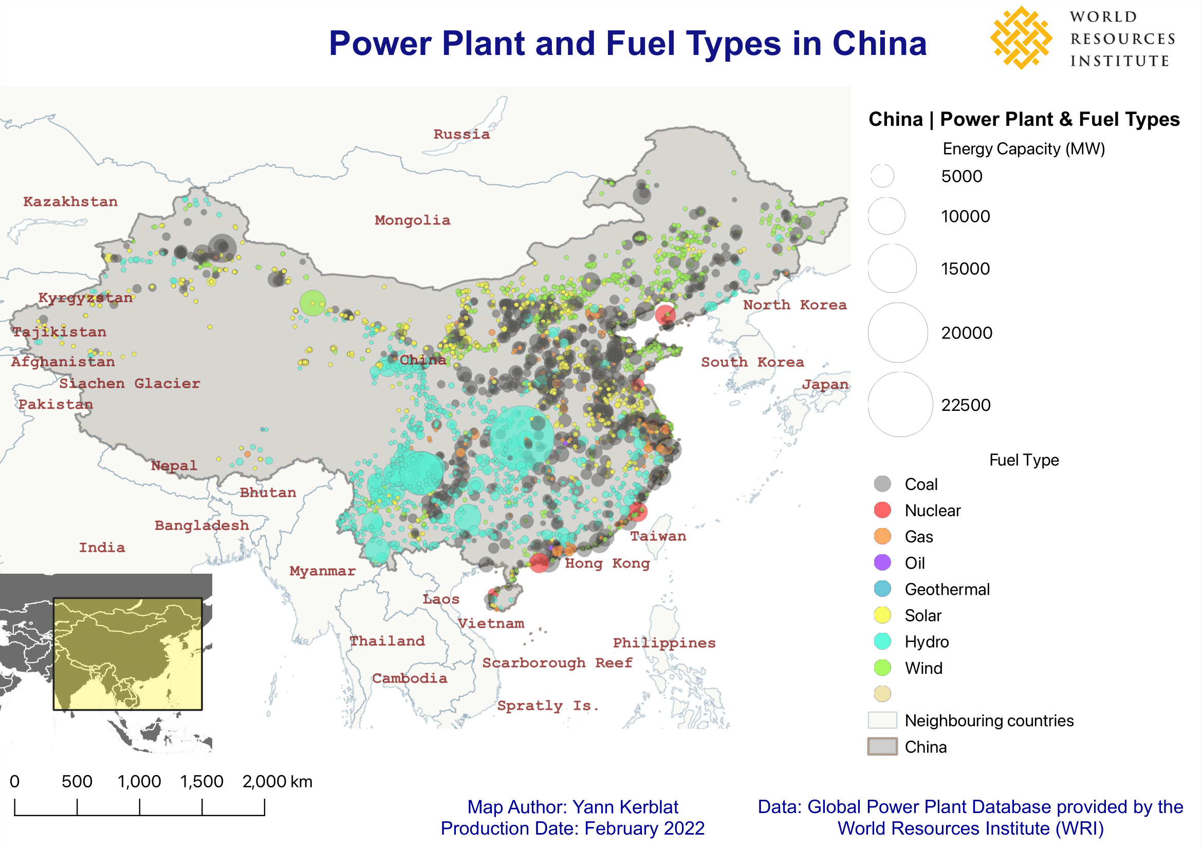
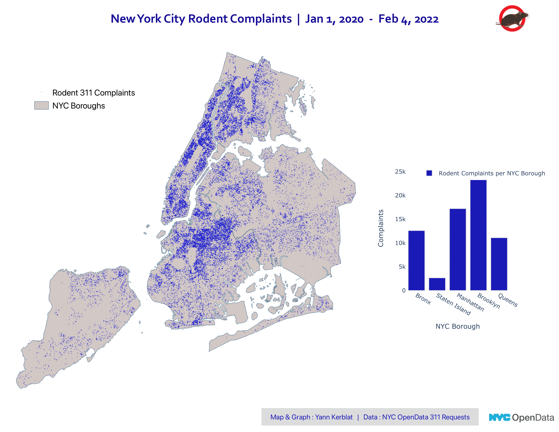
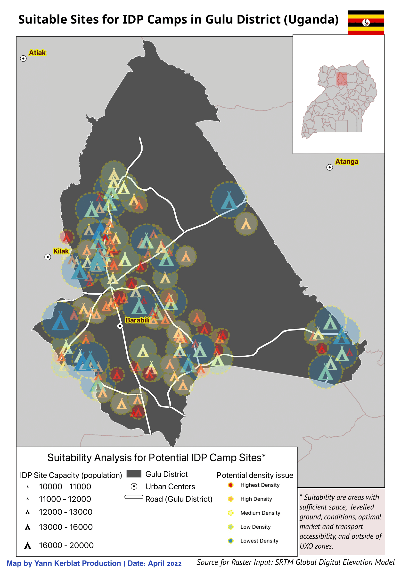
This selection of GIS products were made with QGIS and cover different use cases, ranging from undertaking a multi-criteria suitability analysis for potential Internally Displaced Populations (IDP) camps in Uganda to georeferencing urban patterns of 311 rodent complaints across NYC during the earlier phase of the COVID-19 pandemic.
Remote Sensing & Geospatial Analysis
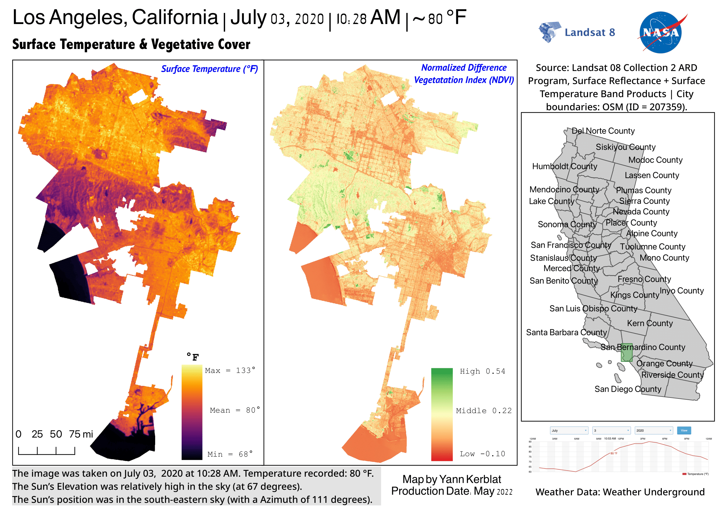
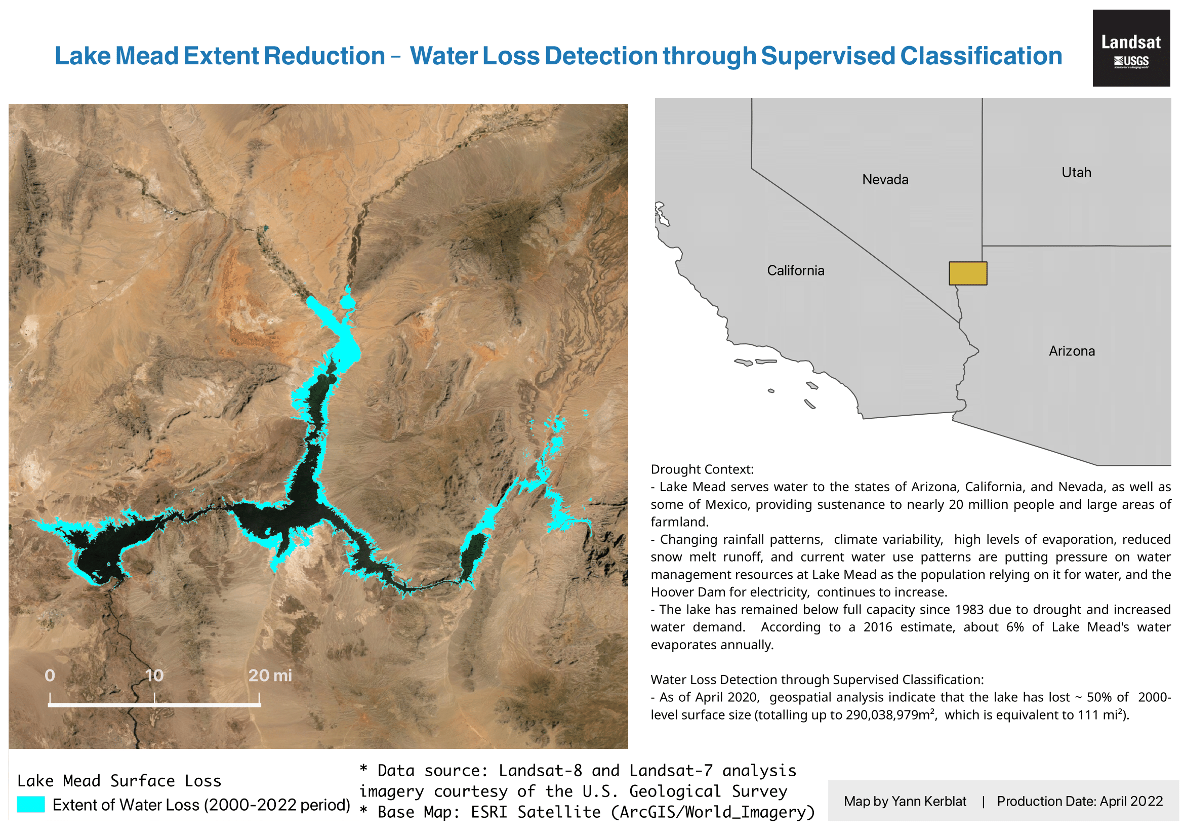
Remote sensing technology and raster classification methods are used to observe changes over time (temporal comparison) in terms of water scarcity in Lake Mead (Nevada), or to map out thermal amplitude patterns across the city of Los Angeles in July 2020.
GIS components & methodologies include:
- Testing different datasets (CSV, SHP, GeoJSON, TIFF)
- Geocoding latitude and longitude coordinates
- Conducting Zonal Statistics for manipulation of spatial and demographic data
- Testing different symbolization strategies (proportional, categorical, dot density, heatmaps)
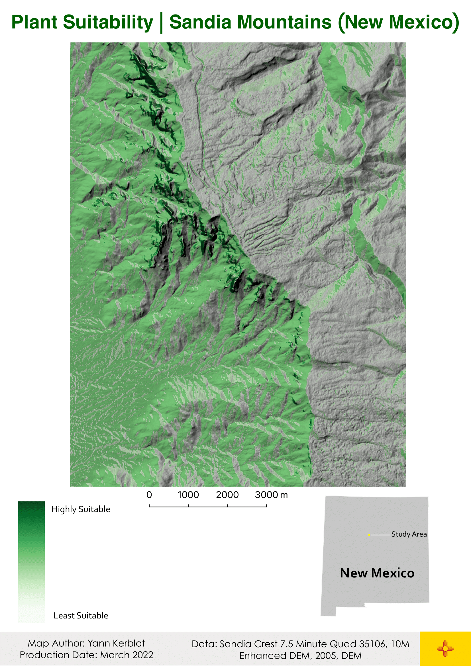
- Manipulating raster data & features reclassification (i.e. determining suitability level of a given terrain)
- Analyzing Digital Elevation Models (DEMs) with different raster surfaces (hillside, contours, slope)
- Converting rasters into vector features (+ vice versa)
- Use classification techniques for remote sensing imagery (Landsat or Sentinel) through multispectral imagery and band combinations to facilitate comparisons overtime and interpret remote sensing indices (NDVI, Land Surface Temperature)
Tools & Datasets
- QGIS
- OpenStreetMap (OSM)
- Data inputs annotated on each map